
|
Introduction | Overview | Atmosphere | Surface ocean | Subsurface ocean | | Ocean Acidification
Arctic Sea Ice Extent

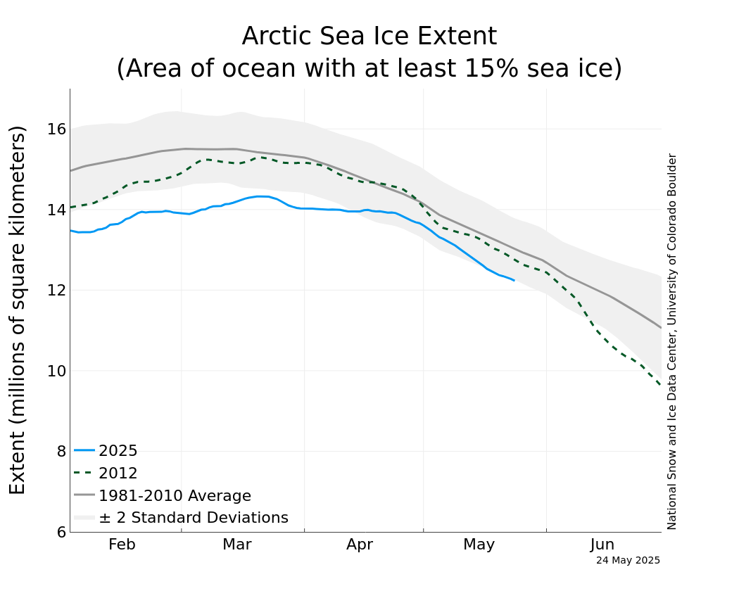
The image above comes from the US National Snow and Ice Data Center, and shows the daily sea ice extent from remotely-sensed microwave imagery of sea ice, for 2010 (blue line), as compared to the record low of 2007 (dotted green line), and the 1979-2000 average and ±2 standard deviations (gray line and shading).
Other sources for Arctic and Antarctic Sea Ice indices
The OOPC is working to promote production and coordination of Arctic and Antarctic sea ice indices. The following sites have sea ice products, based on a variety of data sources and algorithms:
- Sea Ice Index, from the US National Snow and Ice Data Center. Maps of current and historical sea ice concentration and extent for both the northern and southern hemispheres, with downloadable datasets.
- The Cryosphere Today, with data from NCEP/NOAA, compiled by William Chapman of the University of Illinois. Maps and indices of current and historical sea ice concentration and extent for both northern and southern hemispheres, with downloadable datasets. HadISST global sea-ice data and diagnostics and indices, from the UK Met Office Hadley Centre. Downloadable datasets of current and historical sea ice coverage for both the northern and southern hemispheres.
- The Polar Science Team of the US National Ice Center. Maps of current sea ice thickness and extent for both the northern and southern hemispheres using a variety of algorithms, with downloadable datasets.
- A discussion on Arctic sea ice on the Roger A. Pielke Sr. Research Group weblog contains links to data and research on Arctic sea ice.
|


