 |
 |
Introduction | Overview | Atmosphere | | Subsurface ocean | Sea Ice | Ocean Acidification Uncertainty calculation for SST indices
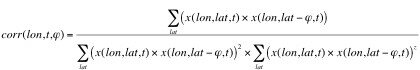
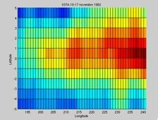
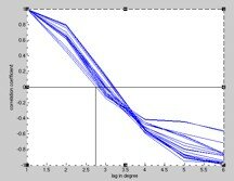
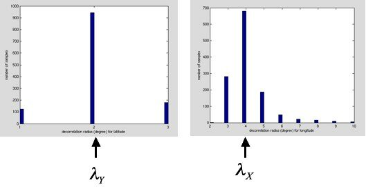
where [sigmaFG] is the "first guess" error, and E the normalized standard deviation [check] that results from the analysis procedure. In order to estimate the error in the index, we have to determine the number of degrees of freedom in the area that defines the index. This was done empirically, by estimating a decorrelation scale. The meridional and zonal lag-correlation coefficients were calculated
and the lag corresponding to the first zero crossing was considered the characteristic spatial scale of the field.
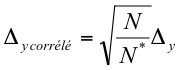
The number of degrees of freedom is estimated by:
where N-S is the north-south extent, and E-W the east-west extent of the box defining the index. The propagation of uncertainty in the calculation of the index therefore:
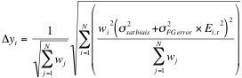
where [w_j] are the weights associated with the surface area represented by the grid point. The error in the index is therefore:
where N is the number of grid points involved in the calculation, and [delta y] is an estimate of the error assuming the number of degrees of freedom is N:
[more details soon] |
 ,
,
 [traduction correlated]
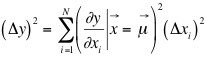
| OOPC Secretariat - IOC/UNESCO - 1 rue Miollis - 75732 Paris cedex 15 - France | © 2005-6 IOC/UNESCO |